Bear Lake ATV Trails Overview
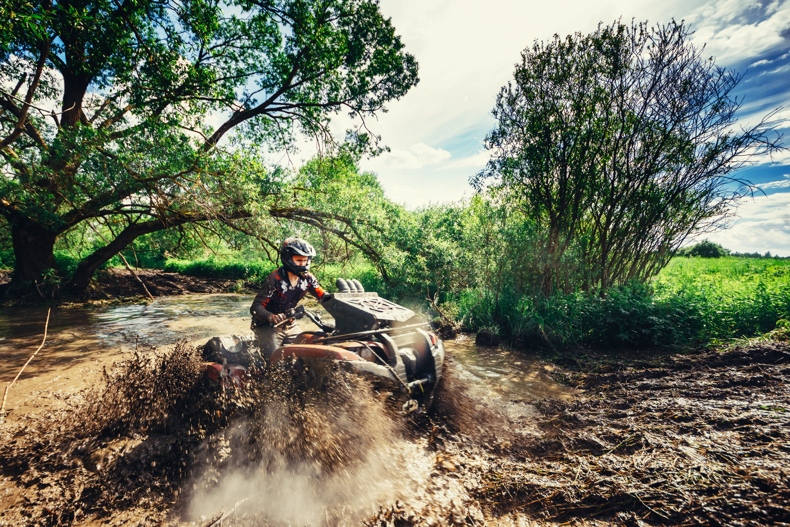
From the challenging ascents of Richardson Canyon to the serene meanderings of Sweetwater View Trail, Bear Lake’s ATV trails cater to ATV riders of all skill levels and preferences with miles of ATV trails to choose from. Whether you seek adrenaline-pumping thrills or tranquil moments amidst nature, Bear Lake’s trails promise an unforgettable ATV experience. This comprehensive guide will through the top picks with all the maps and details you’ll need to have a great time.

Interactive Maps for OHV & Off-Road Trails
- Interactive Map: Use this interactive map of the following ATV trails for additional information.
- You can also see more ATV trails north of Bear Lake here.
Popular Bear Lake ATV Trails
1. Kramer Trails: Exploring Utah’s Hidden Gem
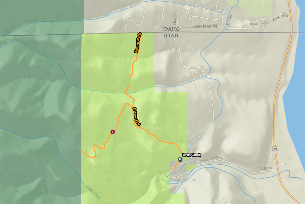
Tucked away near the Utah-Idaho border, this trail system offers a blend of natural beauty and thrilling terrain. The main trail, stretching 1.5 miles, winds westward through the foothills of the Bear River Range. Along the way, riders are treated to sweeping vistas of Bear Lake, providing ample opportunities to pause and soak in the scenery.
- Location: Utah Department of Natural Resources property near the Utah-Idaho border.
- Access Point: Parking is available at the end of Swan Creek Lane.
- Main Trail Distance: 1.5 miles
- Elevation Gain: 104 feet
- North Spur Trail Distance: 0.65 miles
- Elevation Gain: 978 feet
2. Swan Flat Road: A Scenic Journey Through Nature’s Splendor
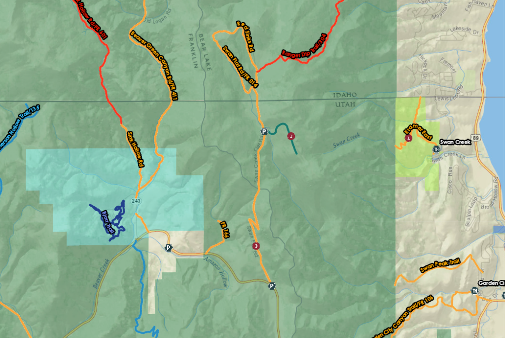
Swan Flat Road (#3 in the map above) offers adventurers a picturesque journey through the heart of nature’s bounty, showcasing the rich tapestry of Utah’s landscapes. Spanning 4.0 miles with an elevation gain of 909 feet, this trail promises a scenic escape into the wilderness. As the trail winds its way forward, it emerges into Swan Flat, a sprawling meadow adorned with vibrant wildflowers and sweeping vistas. Here, travelers can pause and drink in the beauty of their surroundings, basking in the tranquility of this idyllic oasis.
- Location: Swan Flat Rd.
- Distance: 4.0 miles
- Elevation Gain: 909 feet
- Seasonal Availability: Typically opens after snowmelt in June, ideal to see the autumn leaves
3. Garden City Canyon Trail: See the Majesty of Bear Lake’s Backcountry
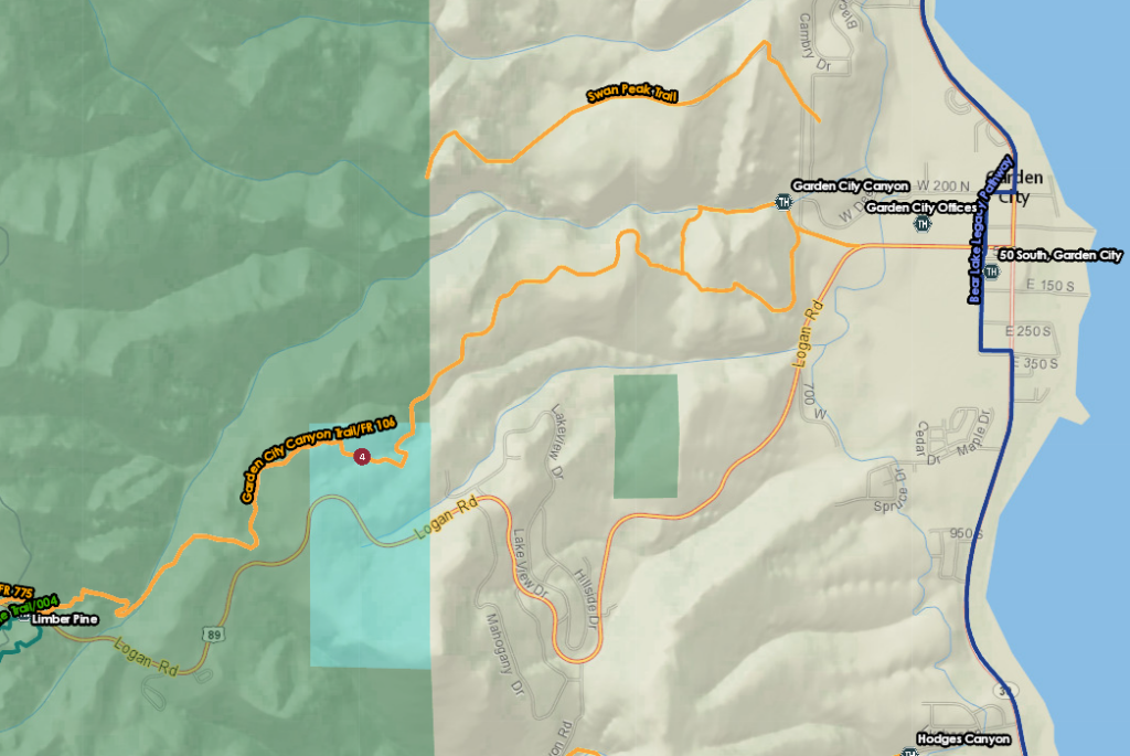
Spanning 4.8 miles and boasting an elevation gain of 1,630 feet, this trail promises adventurers a thrilling odyssey through rugged terrain and breathtaking vistas. As the trail unfolds, travelers are treated to a symphony of natural marvels, with groves of aspens painting the landscape with their vibrant hues. Eventually, it passes under Hwy 30, forging a connection to Sinks Rd. and opening the door to further exploration of the region’s hidden treasures.
- Trail Name: Garden City Canyon Trail
- Distance: 4.8 miles
- Elevation Gain: 1,630 feet
- Trail Features: Two routes from the parking area, scenic views, groves of aspens, and connection to Sinks Rd.
- Difficulty: Shorter, difficult route up the canyon; longer, easier route to the south
4. Hodges Canyon Trail: A Scenic Journey Through Utah’s Wilderness
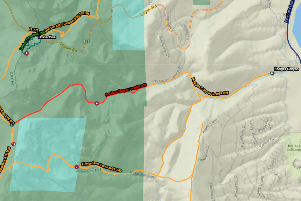
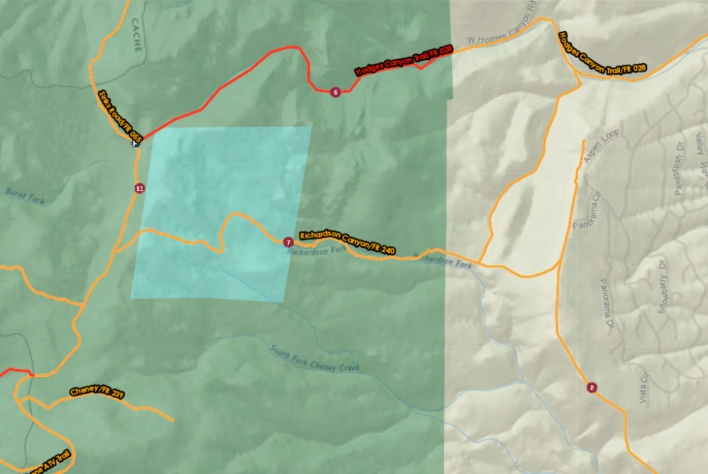
The Hodges Canyon Trail beckons adventurers to explore the rugged beauty of Utah’s wilderness, offering a scenic journey through pine-scented forests and picturesque valleys. Spanning 5.2 miles with an elevation gain of 1,800 feet, this trail promises an exhilarating outdoor experience for hikers, bikers, and OHV enthusiasts alike.
- Trail Name: Hodges Canyon Trail
- Distance: 5.2 miles
- Elevation Gain: 1,800 feet
- Trailhead: Hodges Canyon Rd
- Trail Features: Narrow valley, stream crossings, pine and aspen forest
- Trail Closure: Upper part closed to OHV over 50 inches
5. Richardson Canyon Trail: A Challenging Climb
The Richardson Canyon Trail presents adventurers with a challenging yet rewarding journey through the rugged wilderness of Utah’s backcountry. Spanning 4.4 miles with an elevation gain of 1,645 feet, this trail offers a thrilling ascent to breathtaking views of Bear Lake and its surrounding landscapes. If you are looking for mountain trails this would be for you.
- Trail Name: Richardson Canyon Trail
- Distance: 4.4 miles
- Elevation Gain: 1,645 feet
- Access Points: Sweetwater View or Hodges Canyon
- Trail Conditions: Deep ruts, rocks, fallen limbs
6. Sweetwater View Trail: Explore the Foothills of the Bear River Mountains
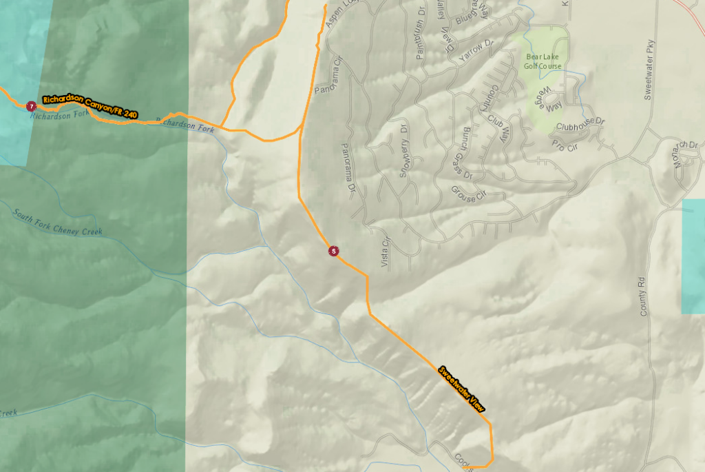
The trail winds through the foothills of the Bear River Mountains, offering breathtaking vistas of Bear Lake. It’s an ideal route for an evening ride, allowing riders to capture the beauty of the setting sun casting its golden glow over Bear Lake. Additionally, a northern spur connects to Richardson Canyon and the Sinks trail system, providing further exploration opportunities.
- Trail Name: Sweetwater View Trail
- Distance: 3.75 miles
- Elevation Gain: 1,154 feet
- Trail Features: Foothills of the Bear River Mountains, panoramic views of Bear Lake valley
- Spur Trail: Leads to Richardson Canyon and the Sinks trail system
7. Peter Sinks Trail: A Wild and Wet Ride
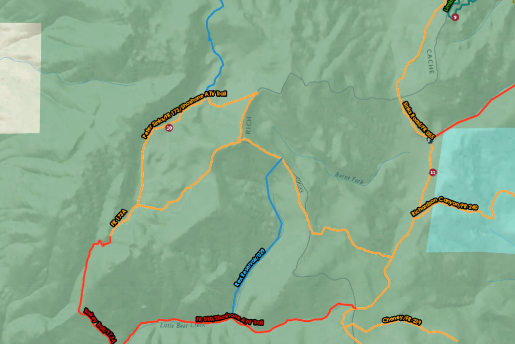
Embark on an unforgettable journey through the mysteries of nature with the Peter Sinks Trail. This 7.7-mile loop traverses through the enchanting landscapes of Douglas firs and Engelmann spruce forests before revealing the hidden wonders of the sinks. Be prepared for damp and boggy conditions, especially in low-lying areas where moisture collects.
- Trail Name: Peter Sinks Trail
- Distance: 7.7 miles
- Elevation Gain: 630 feet
- Terrain: Douglas firs and Engelmann spruce forests, meadows with sinkholes
- Unique Feature: Sinkholes with the coldest temperatures recorded in the continental U.S.
- Trail Conditions: Narrow passages between trees, damp and boggy sections
8. Sinks Rd – Hells Hollow – Danish Dugway: Exploring the Heart of the Bear River Range
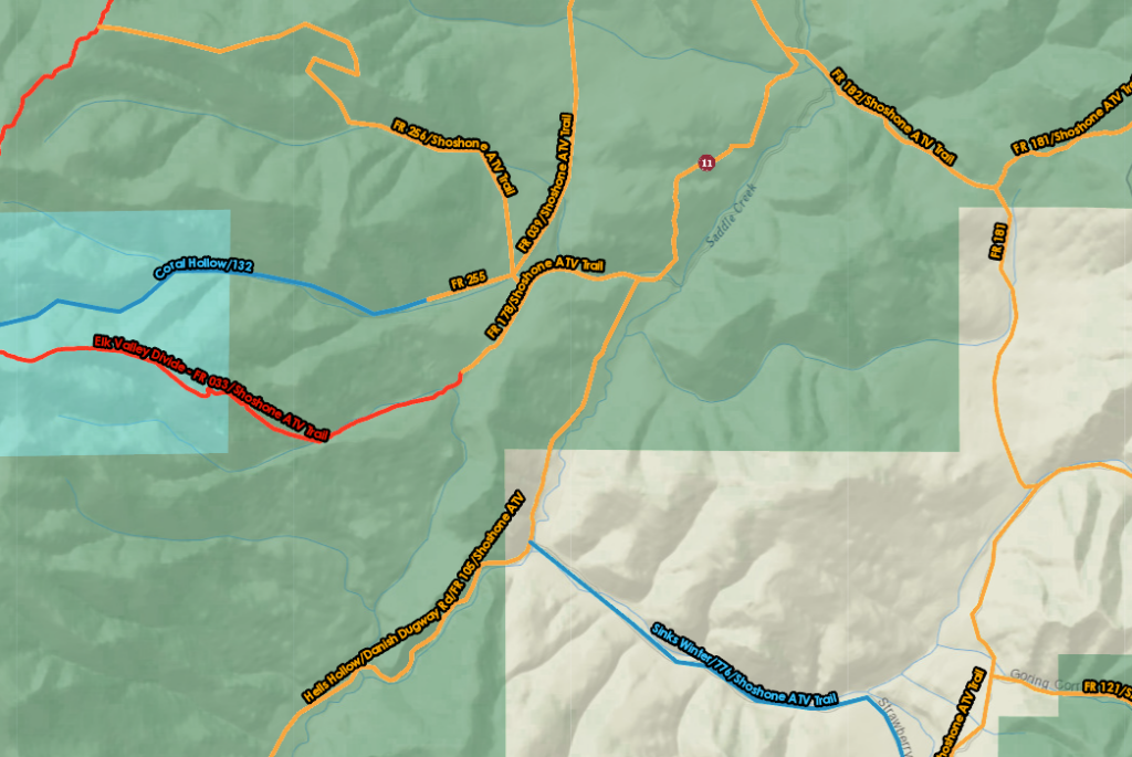
Stretching 22.5 miles with an elevation gain of 2,232 feet, this trail promises adventurers miles of ATV and Bear Lake fun time. Starting from Highway 89, Sinks Rd leads south, winding its way in and out of dense aspen and pine forests. As travelers progress along the route, they are treated to glimpses of the range’s diverse terrain, with opportunities to explore meadows, valleys, and towering peaks.
- Route Name: Sinks Rd – Hells Hollow – Danish Dugway
- Distance: 22.5 miles
- Elevation Gain: 2,232 feet
- Difficulty: Easy
- Terrain: Winding through aspens and pines, exploring meadows, Bear Lake Valley
- Seasonal Accessibility: Typically difficult to ride before Memorial Day, depending on winter conditions
9. Temple Canyon – Temple Fork Trail: For Wildlife Lovers
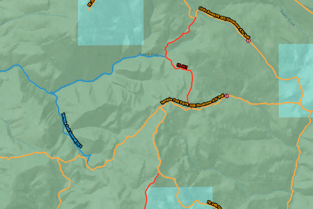
Stretching 16.8 miles with an elevation gain of 2,187 feet, this trail offers opportunities for wildlife sightings with glimpses of deer, elk, and other native species adding to the allure of the journey. The trail also serves as a gateway to several other trails, providing adventurers with endless possibilities for exploration and discovery.
- Trail Name: Temple Canyon – Temple Fork Trail
- Distance: 16.8 miles
- Elevation Gain: 2,187 feet
- Starting Point: Meadowville
- Terrain: Sagebrush, cedars, pines, aspens
- Scenic Highlights: Views of Bear Lake, wildlife sightings
- Trail Features: Access to several other trails, ideal for day trips or weekend adventures
- Seasonal Accessibility: Usually difficult to ride before Memorial Day, dependent on winter conditions
10. Cottonwood Canyon – Laketown Rd Trail: Valley and Meadow ATV Riding
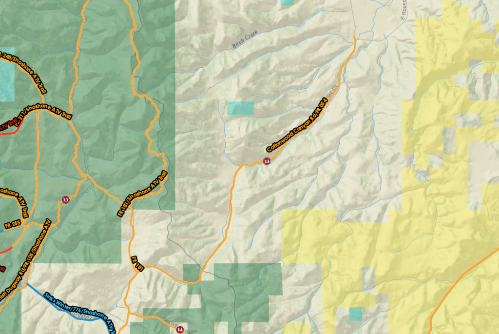
Beginning its path south from Round Valley Draw Road, the trail meanders through a tapestry of valleys and meadows, each turn revealing a new vista of Utah’s scenic beauty. As ATV riders traverse the route, they are greeted by sweeping panoramas of the surrounding National Forest. The trail ends near another popular trail at Logan Canyon. ATV Trail # 255 is located about 6.5 miles up the Hardware Ranch Road in Logan Canyon if you want to hit them both.
- Trail Name: Cottonwood Canyon – Laketown Rd Trail
- Distance: 19.4 miles
- Elevation Gain: 1,653 feet
- Starting Point: Round Valley Draw Road (it becomes Laketown Rd)
- Terrain: Valleys, meadows, National Forest
- Destination: Laketown Rd, ending at Hardware Ranch Wildlife Management Area
- Features: Several turnoffs for exploring the National Forest, caution advised for private property
11. New Canyon – Forest Road 121 Trail: Discovering Utah’s Tranquil Wilderness
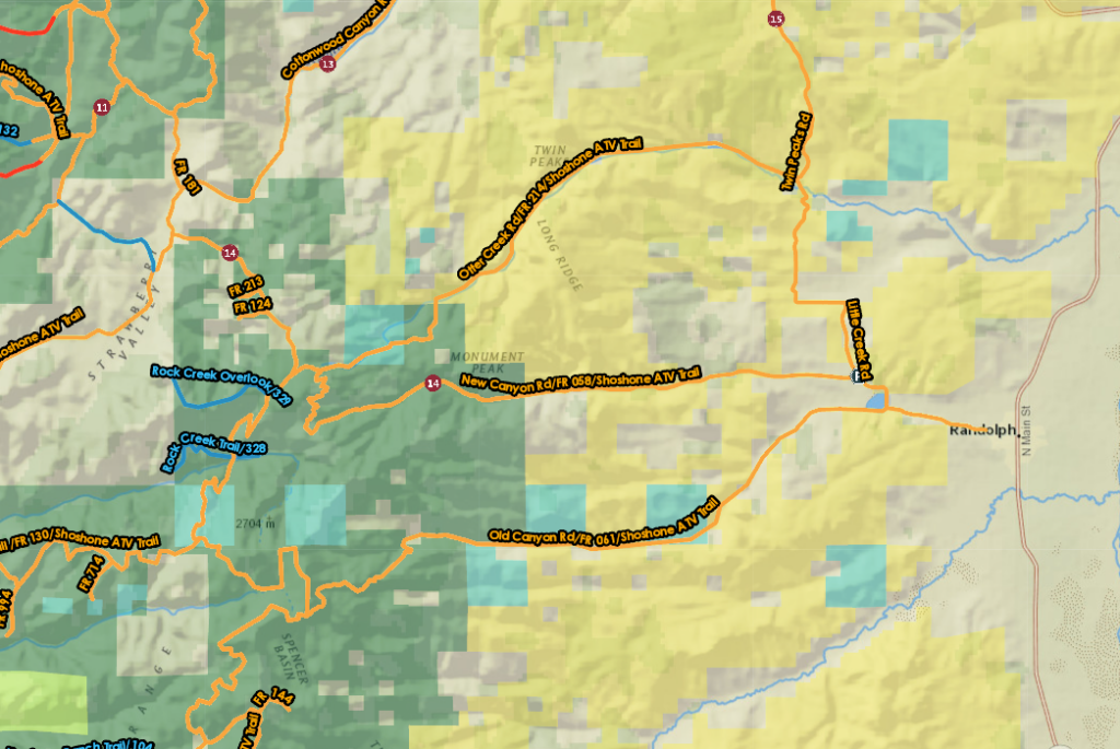
New Canyon starts west of Randolph near Little Creek Reservoir, the trail leads adventurers through picturesque sagebrush hills, offering vistas of untouched landscapes. As the trail progresses, it ascends into the embrace of aspen groves and conifer forests within the National Forest, enveloping travelers in the fragrant scents and serene ambiance of the wilderness. Eventually, the trail transforms into Forest Road 121, leading travelers on a scenic journey that culminates at Cottonwood Canyon/Laketown Rd
- Trail Name: New Canyon – Forest Road 121 Trail
- Distance: 15.7 miles
- Elevation Gain: 1,797 feet
- Starting Point: West of Randolph near Little Creek Reservoir
- Terrain: Sagebrush hills, aspens, and conifer forests in the National Forest
- Destination: Ends at Cottonwood Canyon/Laketown Rd
12. Twin Peak Rd – Otter Creek Rd – Little Creek Rd Trail: Exploring the Bear Lake Plateau
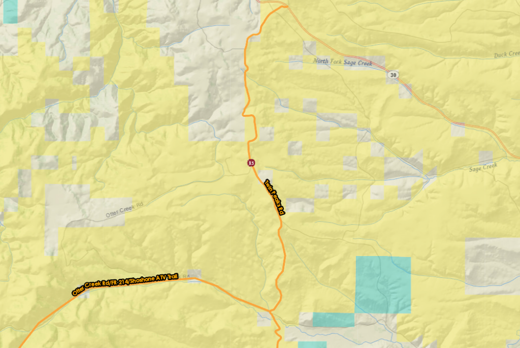
Commencing in Randolph, the trail leads adventurers past the serene waters of Little Creek Reservoir and campground, managed by the Bureau of Land Management (BLM). As travelers progress, they ascend through the rolling sagebrush hills that characterize the Bear Lake Plateau, each step revealing new vistas of untamed beauty.
- Trail Name: Twin Peak Rd – Otter Creek Rd – Little Creek Rd Trail
- Distance: 13.5 miles
- Elevation Gain: 929 feet
- Starting Point: Randolph
- Terrain: Sagebrush hills of the Bear Lake Plateau
- Destination: State Route 30, 7 miles east of Laketown
- Connections: New Canyon, Old Canyon Rd, and Otter Creek Rd
13. Eastern Interlaken Trail: Exploring the Scenic Bluffs of Bear Lake
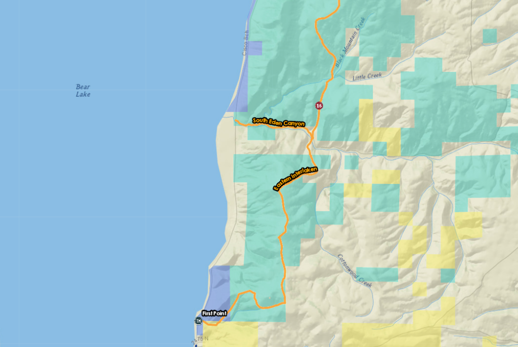
This trail showcases the scenic bluffs of Bear Lake on the Eastern Interlaken. Stretching 9.9 miles with an elevation gain of 1,629 feet, this trail promises an immersive exploration of Bear Lake’s eastern landscape.
- Trail Name: Eastern Interlaken Trail
- Distance: 9.9 miles
- Elevation Gain: 1,629 feet
- Starting Point: First Point (Bear Lake State Park)
- Terrain: Eastern bluffs of Bear Lake, sagebrush flats of the Bear Lake Plateau
- Trail Features: Trail spur to Black Mountain (7,700′) offering panoramic views
- Destination: Hills south of North Eden Canyon
Safety and Regulations
When embarking on ATV adventures around Bear Valley, it’s essential to adhere to safety protocols and regulatory guidelines to ensure a secure and enjoyable experience.
ATV Registration and Permits
Before hitting the trails, ensure your ATV is properly registered and permitted according to local regulations. Additionally, make sure you have the necessary insurance coverage for your vehicle.
Speed Limits and Trail Rules
Respect posted speed limits and trail regulations to maintain safety for yourself and others. Keep in mind that different trails may have varying speed limits and rules, so always be vigilant and observant of signage.
Wildlife and Environmental Conservation Guidelines
Bear Valley is home to diverse wildlife and fragile ecosystems. Be mindful of your surroundings and adhere to wildlife and environmental conservation guidelines. Avoid disturbing wildlife, stay on designated trails, and properly dispose of any waste to help preserve the natural beauty of the area.
Riding Requirements & Regulations
While ATV and dirt bike riding can be thrilling, it’s important to comply with local regulations and safety standards. When riding on paved roads, the following requirements must be met:
- Rearview mirror
- Turn signals
- Horn
- High/Low beam headlight
- Taillight and brake light
- Registration and insurance on the vehicle
- Current license plate with off-road sticker
- Helmet for riders under 18 years of age
For comprehensive ATV rules and regulations specific to Utah and Idaho, please refer to the following resources:
Where to Rent an ATV near Bear Lake
Looking to rent an ATV or UTV side-by-side in Bear Lake? We have some great local outfitters stand ready to kickstart your backcountry adventure. UTVs are street-legal here, so after grabbing these local tips, you’re set to explore.
- Locations: 1217 S Bear Lake Blvd, Garden City, UT
- Contact: (435) 946-3200
- Offerings: Choose from the 4-seat Can-Am Maverick 1000 or the 6-seat Can-Am Defender HD8 to explore mountain trails and the Bear Lake Valley. Serving visitors since 1998.
- Location: 11808 N Highway 89, Logan Canyon, UT
- Contact: (435) 946-3400 or (800) 946-4485
- Offerings: Located in Logan Canyon, Beaver Creek Lodge offers 2-seater, 4-seater, and 6-seater Can-Am UTV rentals for short tours or full-day mountain explorations.
- Location: 201 N Bear Lake Blvd, Garden City, UT
- Contact: (435) 946-3742
- Offerings: Epic Adventure Center provides 2-seater, 4-seater, and 6-seater UTV side-by-side rentals conveniently close to the trails. Perfect for family outings and off-road adventures in the Bear Lake Valley.
Where To Stay For Your Next Bear Lake Adventure
Make your adventure complete with a comfortable stay at Bear Lake Premier Cabins. Whether you’re seeking a cozy retreat after a day of exploration or a relaxing haven amidst nature’s beauty, our cabins offer the perfect accommodation for your Bear Lake getaway. Book your stay now and elevate your ATV adventure with Bear Lake Premier Cabins.

